Today I started out from Newport Bus Station, heading through the town and across the river to start the Medina Greenway Cycle Path N120 from the Riverside Centre, opposite the Bargeman's Rest. It is a gravelled path, so fine for wet winter walking.
At this end of the Medina is Newport Harbour, from which the island's main town takes its name, first recorded in the 12th century. Despite outbreaks of Black Death and incursions by French forces, the town's trade grew over the years. By the 18th century, there was a lot of trade in corn, coal, timber and beer and Newport was a thriving working port until the late 19th century, situated at the centre of the island's rail network. Today it is purely a leisure harbour.
At the beginning of the path is the imposing red brick building, Jubilee Stores, which now houses artists studios. It was originally the grain store for a Newport miller company James Thomas and Co. Ltd, then used as general storage, before being taken over by Quay Arts.
The path leads along the Medina Estuary on the left and past recreation fields on the right.
The Estuary mudflats and Dodnor Creek are important nature conservation areas for wild flowers and butterflies as well as providing feeding ground for a variety of birds, including little egret, oystercatchers,curlew, black tailed godwits, grey herons, redshank, mallard, coots and swans, which can be seen across the river in the Medina Riverside Park.
Just as the Island Harbour comes into view, we pass the rusting hulk of the paddle steamer, Ryde Queen. She was in use as a passenger ferry between the mainland and the island from 1937 to 1969, serving as minesweeper and anti aircraft ship in WW2. In 1944, defending the Omaha beaches, she was hit in her engine room by a shell, but it did not explode and she was able to return safely to Portsmouth. After a stint offering cruises on the Thames, she was fitted out with luxury cabins, a restaurant, bar and dance-floor, and was renamed the Ryde Queen Boatel in 1972, but caught fire in 1977. The damage was repaired and she reopened as a nightclub until she closed in 1989 and has lain derelict ever since.
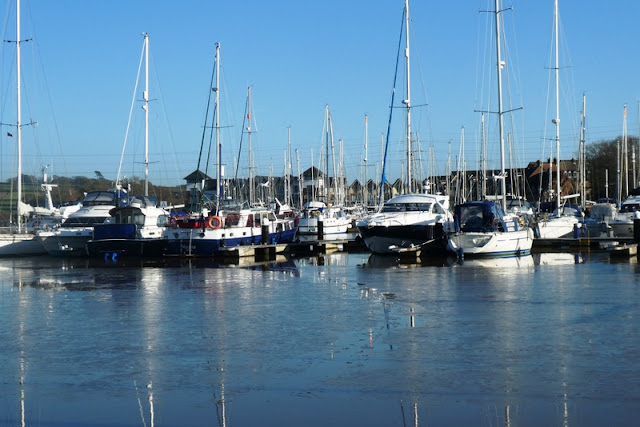
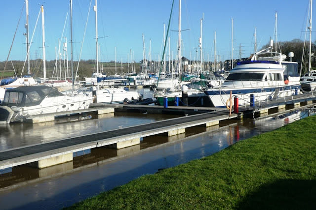
Just round the corner is the picturesque Island Harbour Marina, with its moored yachts and pleasure craft.
The Island Harbour houses a restaurant called The Breeze, where I stopped for a very good seafood linguini. It is also now home to the original Spice Girls Tour Bus, now operating as an Air BandB rental.
Across the bridge, the footpath continues for on to Whippingham and St Mildred's Church, but from here on the path is unmade and can be very muddy. I do not do mud.
After .75 miles, you reach the Folly Inn, with its many outside tables and moorings for boats sailing down the Marina for the day. It is also possible to pick up a water taxi here to go back to East Cowes.
A 15 minute walk along Mill Rd took me back up to the main road, turning right at the end to pick up the No 5 or 9 bus back to Newport.
 |
| Walk Details |
Start: Newport Bus Station
Finish: Island Harbour
Distance: 3 miles
Time: 50 minutes
Bus: No 5 or 9 from Newport to Whiteposts stop on Fairlee Rd
Refreshments/WC: The Breeze restaurant, Island Harbour


No comments:
Post a Comment