The lane alongside the New Inn, Mill Road, follows the creek to a boatyard. With the exception of the final section around Clamerkin Lake, the walk is all on tarmac paths so is good for winter.
Today there were huge flocks of Canada Geese on the waters.
There is no walking route around the coast at this point, so once the boatyard is reached I retraced my steps.
Normally, just before the New Inn, Mill Lane leads to a footbridge over the creek and a path towards Newtown, but today the bridge was under replacement, so I walked back along the main road to the Dairy Deli, where Corf Road leads into Town Lane, with the option of taking a footpath parallel to the road on the inside of the hedge. We reach the Causeway Lake and from here can either follow the road into Newtown village or, when its dry underfoot, take the footpath along the lake.
Even if going by road it is worth a detour back along the gravel track to see the views of the lake.
The footpath leads into the old Newtown, which was originally called Francheville (Freetown) and grew up as a 'new town' around the natural harbour in the 13th century; the original street plan can still be seen in its roads and footpaths. It became a prosperous harbour town with a saltworks and oysterbeds. It is thought that the town declined with the invasion from the French in 1377 and outbreaks of plague until it was almost deserted.
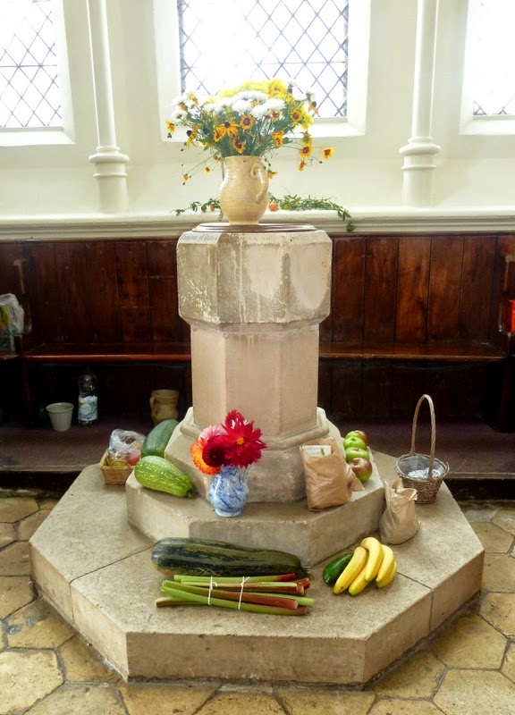
Newtown's Church of the Holy Spirit is a Victorian replacement of an earlier chapel. Harvest offerings were on show during my visit.
In the churchyard is this row of 16 graves all belonging to the local Kingswell Family.
Just past the church, a path leads up towards a bird hide equipped with several telescopes for observing the birds nesting on the far banks.
The footpath running behind the hide would be muddy in winter, but today it was a quick cut to the end of the causeway that projects into the salt marshes; the town's decline seems to have been assured once the harbour silted up.
However, the causeway is a very popular subject for photographers, so I had to add to the myriad already on the web!
The path heads back around two former salt pan feeder ponds, as salt production was a major industry here from medieval times until the 1930s. Here we pass two square pans separated by levees.
Now a private home, this was the Newtown Arms Inn until 1916, also known as Noah's Ark and bears the coat of arms of "S. Comatis de Francheville de L’ile de Wyht".
Just down the lane is the former Town Hall, built in 1699 with two members of Parliament, but with just few cottages with eligible voters, it soon became a Rotten Borough and the Town Hall fell into disuse until given to the National Trust who keep it open to the public. (See visiting hours.) Just opposite is a car park with a NT visitor centre and WC.
Behind the town hall Town Lane, or a parallel footpath across fields, leads to Clamerkin Lake and the eastern estuary. A footpath leads through Walter's Copse to the lake; keep to paths inside the woods as the banks are very soft mud.
I returned via a second woodland path, but it was a bit hard to follow, so next time I'll take the same path back to come out back on Town Lane, which leads a junction. Turning right along Corf Road will lead back to the New Inn but I crossed over and took the lane opposite to come out at the bus stop on the Yarmouth Rd.
 | ||||
| Walk Details |
Start: Shalfleet Church
Finish: Yarmouth Road
Distance: 6.7miles
Time: 4 hours
Refreshments: New Inn, Shalfleet, Dairy Deli
WC: New Inn and National Trust Visitor Centre Newtown


No comments:
Post a Comment